Anuradhapura (Sinhalese: අනුරාධපුරය ; Tamil: அனுராதபுரம்) is a major city in Sri Lanka. It is the capital city of North Central Province, Sri Lanka and the capital of Anuradhapura District. Anuradhapura is one of the ancient capitals of Sri Lanka, famous for its well-preserved ruins of ancient Sri Lankan civilization. It was the third capital of the Kingdom of Rajarata, following the kingdoms of Tambapanni and Upatissa Nuwara. The city, now a UNESCO World Heritage Site, was the center of Theravada Buddhism for many centuries. The city lies 205 km north of the current capital Colombo in Sri Lanka's North Central Province, on the banks of the historic Malvathu Oya. It is one of the oldest continuously inhabited cities in the world and one of the eight World Heritage Sites of Sri Lanka.

Poḷonnaruwa (Sinhalese Poḷonnaruwa or Puḷattipura, Tamil Polaṉṉaṟuvai or Puḷatti nakaram) is the main town of Polonnaruwa District in North Central Province, Sri Lanka. Kaduruwela area is the Polonnaruwa New Town and the other part of Polonnaruwa remains as the royal ancient city of the Kingdom of Polonnaruwa. The second most ancient of Sri Lanka's kingdoms, Polonnaruwa was first declared the capital city by King Vijayabahu I, who defeated Chola invaders in 1070 to reunite the country once more under a local leader. The Ancient City of Polonnaruwa has been declared a World Heritage Site.

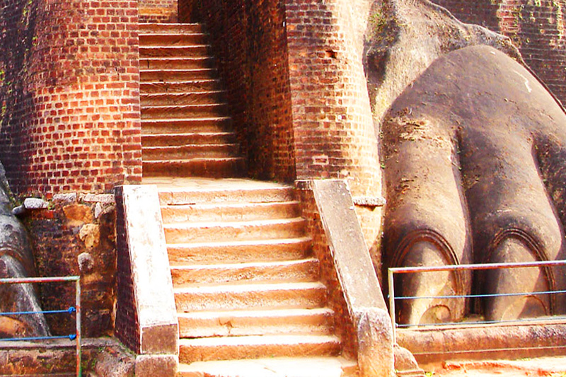
Sigiriya (Lion Rock Sinhalese: සීගිරිය, Tamil: சிகிரியா, pronounced see-gi-ri-yə) is an ancient palace located in the central Matale District near the town of Dambulla in the Central Province, Sri Lanka. The name refers to a site of historical and archaeological significance that is dominated by a massive column of rock nearly 200 metres (660 ft) high. According to the ancient Sri Lankan chronicle the Culavamsa, this site was selected by King Kasyapa (477 – 495 CE) for his new capital. He built his palace on the top of this rock and decorated its sides with colourful frescoes. On a small plateau about halfway up the side of this rock he built a gateway in the form of an enormous lion. The name of this place is derived from this structure —Sīhāgiri, the Lion Rock. The capital and the royal palace was abandoned after the king's death. It was used as a Buddhist monastery until the 14th century.

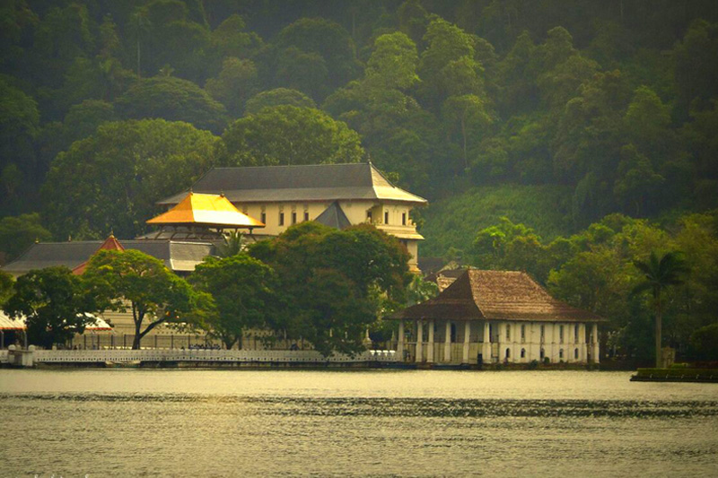
Kandy (Sinhalese: මහ නුවර Maha nuwara, pronounced [mahaˈnuʋərə]; Tamil: கண்டி, pronounced [ˈkaɳɖi]) is a major city in Sri Lanka, located in the Central Province, Sri Lanka. It is the second largest city in the country after Colombo. It was the last capital of the ancient kings' era of Sri Lanka.[1] The city lies in the midst of hills in the Kandy plateau, which crosses an area of tropical plantations, mainly tea. Kandy is both an administrative and religious city and is also the capital of the Central Province. Kandy is the home of The Temple of the Tooth Relic (Sri Dalada Maligawa), one of the most sacred places of worship in the Buddhist world. It was declared a world heritage site by UNESCO in 1988

Dambulla (Sinhalese: දඹුල්ල Dam̆bulla, Tamil: தம்புள்ளை Tampuḷḷai) is a large town, situated in the Matale District, Central Province of Sri Lanka, situated 148 km (92 mi) north-east of Colombo and 72 km (45 mi) north of Kandy. Due to its location at a major junction, it's the centre of vegetable distribution in the country. Major attractions of the area include the largest and best preserved cave temple complex of Sri Lanka, and the Rangiri Dambulla International Stadium, famous for being built in just 167 days. The area also boasts the largest rose quartz mountain range in South Asia, and the Iron wood forest, or Na Uyana Aranya.

Royal Botanical Garden, Peradeniya is about 5.5 km to the west from the city of Kandy in the Central Province of Sri Lanka. It attracts 2 million visitors annually. It is near the Mahaweli River (the longest in Sri Lanka). It is renowned for its collection of orchids. The garden includes more than 4000 species of plants, including orchids, spices, medicinal plants and palm trees. Attached to it is the National Herbarium of Sri Lanka. The total area of the botanical garden is 147 acres (0.59 km2), at 460 meters above sea level, and with a 200-day annual rainfall. It is managed by the Division of National Botanic Gardens of the Department of Agriculture.

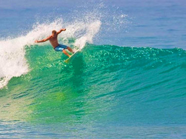
Arugam Bay is a bay situated on the Indian Ocean in the dry zone of Sri Lanka's southeast coast. The bay is located 320 kilometres (200 mi) due east of Colombo, and approximately 4 kilometres (2.5 mi) south of the market town of Pottuvil. The main settlement in the area, known locally as Ullae, is predominantly Muslim, however there is a significant Tamil and Sinhala population to the south of the village, as well as a number of international migrants, largely from Europe and Australia. While traditionally fishing has dominated the local economy, tourism has grown rapidly in the area in recent years. Tourism in Arugam Bay is dominated by surf tourism, thanks to several quality breaks in the area, however tourists are also attracted by the local beaches, lagoons, historic temples and the nearby Kumana National Park.

Hikkaduwa is a small town on the south coast of Sri Lanka located in the Southern Province, about 17 km (11 mi) north-west of Galle and 98 km (61 mi) south of Colombo. The name Hikkaduwa is thought to have been derived from the two words Ship Kaduwa, with Ship being the shorter version of Shilpaya which refers to knowledge in Sinhalese and Kaduwa which means sword. It is believed therefore that the name Hikkaduwa means sword of knowledge.

Pasikudah or Pasikuda (Tamil: பாசிக்குடா; Sinhalese: පාසිකුඩා; Pronounced Paasikkudah, Historic Sinhala Translation (පාසි තුඩුව ,Pasi thuduwa,Pasi-moss Thuduwa-Cape) Tamil translation (Green-Algae-Bay) is a coastal resort town located about 35 kilometers northwest of Batticaloa, Batticaloa District, Sri Lanka. It used to be a popular tourist destination, however due to 2004 Indian Ocean Tsunami and Sri Lankan Civil War tourist numbers have declined. Pasikudah and Kalkudah are located few km apart. Since the end of the civil war in 2009 and the completion of Tsunami rehabilitation projects, Pasikudah has become a popular tourist destination amongst locals and foreigners alike. This is because Pasikudah is known to have one of the longest stretches of shallow coastline in the world. In other words, people walk kilometers into the sea because the water is only a few inches deep and the current is relatively weak compared to the rest of Sri Lanka's coasts.

Trincomalee (Tamil: திருகோணமலை Tirukōṇamalai, Sinhalese: ත්රිකුණාමළය Trikuṇāmalaya) is the administrative headquarters of the Trincomalee District and major resort port city of Eastern Province, Sri Lanka. Located on the east coast of the island overlooking the Trincomalee Harbour, 113 miles south of Jaffna and 69 miles north of Batticaloa, Trincomalee has been one of the main centres of Tamil language speaking culture on the island for over two millennia. With a population of 99,135,[1] the city is built on a peninsula of the same name, which divides its inner and outer harbours. People from Trincomalee are known as Trincomalians and the local authority is Trincomalee Urban Council. Trincomalee city is home to the famous Koneswaram temple alluded to in its historic Tamil name Thirukonamalai and is home to other historical monuments such as the Bhadrakali Amman Temple, Trincomalee, the Trincomalee Hindu Cultural Hall and, opened in 1897, the Trincomalee Hindu College. Trincomalee is also the site of the Trincomalee railway station and an ancient ferry service to Jaffna and the south side of the harbour at Muttur.

Udawalawe National Park lies on the boundary of Sabaragamuwa and Uva Provinces, in Sri Lanka. The national park was created to provide a sanctuary for wild animals displaced by the construction of the Udawalawe Reservoir on the Walawe River, as well as to protect the catchment of the reservoir. The reserve covers 30,821 hectares (119.00 sq mi) of land area and was established on 30 June 1972.Before the designation of the national park, the area was used for shifting cultivation (chena farming). The farmers were gradually removed once the national park was declared. The park is 165 kilometres (103 mi) from Colombo. Udawalawe is an important habitat for water birds and Sri Lankan elephants. It is a popular tourist destination and the third most visited park in the country.

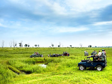
Yala National Park is the most visited and second largest national park in Sri Lanka. The park consists of five blocks, two of which are now open to the public, and also adjoining parks. The blocks have individual names such as, Ruhuna National Park (block 1) and Kumana National Park or 'Yala East' for the adjoining area. It is situated in the southeast region of the country, and lies in Southern Province and Uva Province. The park covers 979 square kilometres (378 sq mi) and is located about 300 kilometres (190 mi) from Colombo. Yala was designated as a wildlife sanctuary in 1900, and, along with Wilpattu was one of the first two national parks in Sri Lanka, having been designated in 1938. The park is best known for its variety of wild animals. It is important for the conservation of Sri Lankan elephants, Sri Lankan leopards and aquatic birds.

Galle (Sinhalese: ගාල්ල; Tamil: காலி) is a major city in Sri Lanka, situated on the southwestern tip, 119 km from Colombo. Galle is the administrative capital of Southern Province, Sri Lanka and is the district capital of Galle District. Galle was known as Gimhathiththa[1](although Ibn Batuta in the 14th century refers to it as Qali[2]) before the arrival of the Portuguese in the 16th century, when it was the main port on the island. Galle reached the height of its development in the 18th century, during the Dutch colonial period. Galle is the best example of a fortified city built by the Portuguese in South and Southeast Asia, showing the interaction between Portuguese architectural styles and native traditions. The city was extensively fortified by the Dutch during the 17th century from 1649 onwards. The Galle fort is a world heritage site and is the largest remaining fortress in Asia built by European occupiers.

Nuwara Eliya (Sinhalese: නුවර එළිය [nuwərə ɛlijə]; Tamil: நுவரேலியா) is a city, in the hill country of the Central Province, Sri Lanka. The city name meaning is "city on the plain (table land)" or "city of light". The city is the administrative capital of Nuwara Eliya District, with a picturesque landscape and temperate climate. It is located at an altitude of 1,868 m (6,128 ft) and is considered to be the most important location for tea production in Sri Lanka. The city is overlooked by Pidurutalagala, the tallest mountain in Sri Lanka. Nuwara Eliya is also known for the temperate, cool climate, the city is known for being the coolest area in Sri Lanka.
© 2016 - 2021 Ceylon Walkers. All rights reserved | Photography : Nayana Chandanei | Site by: Web Design Sri Lanka
